@DestinationRogersAR
Get Connected
Welcome to Maps & Travel Info for Rogers, AR. Here you’ll find interactive maps and downloadable PDFs for the City of Rogers, downtown walking routes, trails & greenways, and airport / regional access. Use these to plan driving routes, walking tours, parking zones, and visitor navigation across Northwest Arkansas.
Maps on this page include: City of Rogers street map & parking zones, Downtown walking & attraction map, Rogers trails & greenway routes, direct flights into Northwest Arkansas National Airport (XNA).
When planning your vacation, it’s helpful to use various resources to get an overview of what Rogers has to offer. Stop into the Rogers Lowell Chamber for detailed maps and travel guides. You can also find guides at Arkansas.com to plan your route and find interesting stops along the way. With the right resources and information, you can tailor your itinerary to include all the highlights that make Rogers a memorable destination.
Make Navigating a Breeze
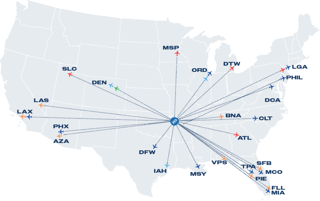
Northwest Arkansas National Airport (XNA) is a short, 12-mile drive from Rogers and offers direct flights to 24 major U.S. cities. Also nearby is Rogers Executive Airport, providing super-efficient access for both domestic and international traveler
Free Download
Rogers Destination Guide
Rogers is the perfect place to experience the cutting-edge along with the nostalgic. Bustling shopping and innovative dining lives harmoniously adjacent to gorgeous scenery and historic sites.
Learn moreUpcoming Events
Learn MoreGet Connected